Best Hikes in Maui: 10 Trails Worth the Sweat (2026)
19 min readYndira W. Tonin
The best hikes in Maui range from a 0.6-mile paved valley stroll to an 11-mile crater crossing, and if you only remember one name, make it the Pipiwai Trail - a nearly flat four miles through a bamboo forest to a 400-foot waterfall. After that, the picks sort themselves by what you're after: Waihee Ridge for the big views, Sliding Sands to walk inside a volcano, Iao Valley for the easy sacred one.
Most of them are free, which is the quiet luxury of hiking here. The difficulty that catches people out isn't the climbing - it's the timing. The same trail at 8 am and at 1 pm are two different hikes, and only one of them has parking, a clear summit, and air you'd call pleasant.
This is a guide to ten trails worth the drive, grouped by corner of the island, with honest distances, parking, fees, and a straight "is it worth it" on each - all current as of 2026. It's built for first timers choosing two or three hikes, not peak baggers, and we'll happily tell you which to skip when you're short on time. (We run beach picnics over on Oahu, not Maui, so there's no stake in your plans here - just the trail notes.)
Cover photo: Strauss Western on Unsplash.
Table of Contents
- The best hikes in Maui at a glance
- Pick your Maui hiking trail by effort and region
- West Maui hikes: ridge views and a coastal lava walk
- Haleakala National Park hikes: the crater and the cloud forest
- Hana and East Maui hikes: bamboo and waterfalls
- Central and South Maui hikes: a sacred valley and a lava coast
- When to hike Maui
- What to pack and how to hike Maui safely
- FAQ: best hikes in Maui
01
The best hikes in Maui at a glance
Maui packs an absurd range of hiking into one island: rainforest, bamboo, a desert volcano summit, a sacred green valley, and a coast made of raw black lava - sometimes three of those in a single morning's drive. For a hiking destination, that range of landscape and experience is hard to beat. You don't need to be especially fit to enjoy most of it. You need grippy shoes, more water than you think, and an early start.
Ten trails, one rule: go early
Here's the honest call, and it's the one locals make: Maui's best hiking is free. The only trail on this whole list that charges is Haleakala (Haleakalā), at $30 a vehicle - and even that buys three days and both districts. Spend your money on the boat to Molokini you genuinely can't reach from shore; don't spend it on a trail you can walk for nothing.
If you only do one hike on Maui, do the Pipiwai Trail (Pīpīwai). It's the rare trail that's easy enough for most families and spectacular enough to anchor a whole day - bamboo forest, two waterfalls, and a payoff you can see from the trail's end. Everything else here is a worthy second or third.
One thing that surprises first timers: Maui's trails sit in wildly different climates stacked within a few miles of each other. You can start a coastal lava walk in full sun, drive 40 minutes, and be shivering in cloud at 9,000 feet. That spread is the whole appeal, and it's exactly why a single "what's the weather on Maui" answer never works - check the forecast for the specific trailhead, not the island.
Getting to the Maui hiking trails
Tap to open Google Maps with turn-by-turn directions.
02
Pick your Maui hiking trail by effort and region
The fastest way to choose is to be honest about two things: how much climbing you actually want, and which part of the island you're near that day. Drive times on Maui are deceptively long - the Road to Hana and the Haleakala summit each eat most of a day - so the smart move is matching the hike to your fitness level and where you already are - a gentle stroll or a real adventure, whichever the day calls for.
Easy stroll, fair climb, or earn-it hard
Easy + family
Short, gentle, paved-ish
- Iao Valley - 0.6 mi paved to the Needle
- Kapalua Coastal Trail - flat ocean walk
- Twin Falls - 1.8 mi to the waterfalls
- Hosmer Grove - 0.5 mi cloud-forest loop
ModerateOur pick
A real hike, no ropes
- Pipiwai Trail - 4 mi, bamboo + Waimoku Falls
- Waihee Ridge - 4 mi, 1,500 ft, the views
- Halemauu - switchbacks to the crater rim
- Best effort-to-payoff on the island
Hard + earn it
Long, hot, or high
- Sliding Sands - up to 11 mi in the crater
- Hoapili / La Perouse - 5+ mi of shadeless lava
- Lahaina Pali - 5 mi, hot and exposed
- Start at dawn or don't start
Effort first. The easy tier (Iao, Kapalua Coastal, Twin Falls, Hosmer Grove) is paved or flat and short, good for kids, jet lagged first mornings, and anyone who wants the scenery without the suffering. The moderate tier (Pipiwai, Waihee Ridge, Halemauu) is where the best payoff per mile lives. The hard tier (Sliding Sands, Hoapili, Lahaina Pali) is long, high, or shadeless, and rewards a dawn start and a little respect.
Then region. Group your hikes by corner of the island so you're not crossing it twice in one day - that's how a "quick hike" turns into five hours in the car.
A realistic Maui week might look like this: an easy Iao or Kapalua stroll on a jet lagged first morning, the Pipiwai Trail folded into a full Road to Hana day, and either Waihee Ridge or a Haleakala crater hike on a clear morning once you've found your legs. That's three distinct corners and three distinct climates with no backtracking. Bolting Hana onto a Haleakala day, by contrast, is the classic over reach that ends with someone driving switchbacks in the dark.
Maui's hikes by corner of the island
West MauiRidge + coast
Waihee Ridge, Kapalua Coastal, Lahaina Pali. Closest to the Kaanapali and Lahaina hotels - 20 to 60 minutes out.
Haleakala + UpcountryCold + high
Sliding Sands, Halemauu, Hosmer Grove. A 1.5 to 2-hour drive up to a 10,000-foot summit. Dress for the 30s and 40s.
Hana + EastMake it the day
Pipiwai and Twin Falls sit on the Road to Hana. Pair them with the drive; don't try to add a second region after.
Central + SouthClosest to base
Iao Valley near Kahului, Hoapili out past Wailea. The easy add-on and the hard add-on, both close to where most people stay.

Photo: Lyle Hastie on Unsplash
03
West Maui hikes: ridge views and a coastal lava walk
West Maui is where most visitors sleep - Kaanapali, Lahaina, Kapalua - so these three are the easiest to reach without spending a travel day to get to the trailhead. They run from a flat ocean stroll to a genuine leg burner, and the views skew big: ridgelines, whale dotted channels, and a coast that makes the rental car feel worth it.
Waihee Ridge Trail
The Waihee (Waiheʻe) Ridge Trail is the best big view hike on Maui for the effort - about four miles round trip with roughly 1,500 feet of climbing to the Lanilili summit. You walk an honest ridge trail with the West Maui Mountains rising on one side and the ocean dropping away on the other, and on a clear morning it's as good as the island gets. The catch is the word "clear": the ridge trail usually socks in with cloud by late morning, sometimes before noon.
Start early, both for the view and for the small trailhead lot off Kahekili Highway on the island's north side, which fills fast in season. The ridge trail is well graded but turns into slick red mud after rain, so the same hike that's glorious in dry sun is a comedy of footing the day after a storm. See our full Waihee Ridge Trail guide for the gate hours, parking, and the section-by-section climb.
Distance: ~4 mi round trip · Effort: moderate, ~1,500 ft up · Time: 2.5-3 hr · The move: be walking by 8 am or you'll hike straight into the clouds.
Kapalua Coastal Trail
The Kapalua Coastal Trail is the easy West Maui counterweight: a flat, mostly paved 1.75 miles each way along the bluffs from Kapalua Bay past D.T. Fleming Beach. It's the kind of walk you do in sandals with a coffee, and it still delivers green sea turtles below, winter whales offshore, and the bizarre lava spires of Makaluapuna Point - the "Dragon's Teeth" - about halfway along.
It's exposed, so there's no shade and the afternoon sun is real, but on a coast this calm that's a minor tax. Pair it with a swim at Kapalua Bay, which sits right at the trailhead and is one of the gentlest snorkel coves on the island.
Distance: ~3.5 mi round trip · Effort: easy, flat · Time: 1.5 hr · The move: go at sunrise or late afternoon to dodge the open sky heat.
Lahaina Pali Trail
The Lahaina Pali Trail is the hard, historic one - a roughly five mile stretch of a 19th-century paved path over the dry mountain shoulder between Maalaea (Māʻalaea) and Ukumehame, climbing around 1,600 feet. It's hot, fully exposed, and genuinely strenuous, with sweeping views of the south coast and, in winter, whales spouting in the channel below. The trail sits up in the mountains, well away from Lahaina town; treat it as the demanding history walk it is, and go with care and water.
This is a dawn hike or a no hike. By midmorning the rock radiates heat and there's not a tree to hide under for miles.
Distance: ~5 mi one way · Effort: hard, hot, exposed · Time: 3-4 hr · The move: start at first light; carry far more water than feels reasonable.

04
Haleakala National Park hikes: the crater and the cloud forest
Up at the summit, Maui stops looking like Maui. Haleakala National Park holds a 10,023-foot volcano whose summit "crater" is a vast cinder desert landscape in reds, browns, and blacks - the closest thing to another planet you can reach in a rental car. The hikes in the summit area are about altitude and cold, not jungle: it can be 40 degrees colder than the beach, and the thin air makes every climb feel like one and a half.
Haleakala is a different planet (and climate)
Sliding Sands Trail
The Sliding Sands Trail - Keoneheehee (Keoneheʻeheʻe) in Hawaiian - is the bucket list crater hike, dropping from the visitor center at around 9,740 feet down into the crater floor across loose cinder. The full crossing to the Halemauu trailhead runs about 11 miles; most people just go down as far as they like and turn back. The colors and the silence make it the most otherworldly hiking experience on the island, like walking across a Martian beach that someone forgot to add water to.
Here's the honest warning: the trail down is the easy half. You descend roughly 2,500 feet on cinder, and every foot is a climb back out at altitude. Skip it if you've got an afternoon flight - people genuinely cut it too close trudging back up - and don't underestimate a "short" out and back here. A guided Haleakala sunrise tour solves the 3 am drive if the dawn version is what you're after; for the hike, just come up after the crowds leave.
Distance: up to 11 mi (or any out and back) · Effort: hard, altitude · Time: 4-7 hr full · The move: budget twice as long for the climb out as the walk down.
Halemauu Trail
The Halemauu (Halemauʻu) Trail is the other crater route, and the more photogenic start: a cliff edge path with steep switchbacks carved into the crater wall, past a feature called Rainbow Bridge. Going just to the rim overlook is about 2.2 miles round trip with a modest 400-foot change - a far gentler taste of the crater than Sliding Sands if you're not up for the full descent.
Go further and you can drop the switchbacks to the crater floor and the Holua cabin area, which turns it into a serious day. For most visitors the overlook is plenty: the view of cloud pouring over the crater rim is the whole show.
Distance: 2.2 mi to the overlook (more if you descend) · Effort: easy to moderate · Time: 1.5-2 hr · The move: pair it with sunrise, then hike while the summit's still clear.
Hosmer Grove Loop
The Hosmer Grove Loop is the soft landing - a half mile nature trail near the park entrance that winds through a cool, fragrant grove of imported pine and cedar trees into native shrubland. It's flat, shaded, and the best spot in the park to actually hear native forest birds, including some you can see nowhere else on Earth.
It's not a "view" hike and it's not trying to be. It's a 30-minute leg stretch and birding stop that makes a perfect bookend to a summit sunrise, while you wait for the air to warm up enough to feel your hands again.
Distance: ~0.5 mi loop · Effort: easy · Time: 30-45 min · The move: go quiet and slow; the birds are the point.

Photo: rjb Studios on Unsplash
05
Hana and East Maui hikes: bamboo and waterfalls
East Maui is the wet, green, tropical waterfall side, and its two best hikes sit on the Road to Hana - which means they're a full day commitment, not a quick add-on. Build the day around the drive, eat the banana bread, and treat the trails as the reward at the far end and the easy stop near the start.
Pipiwai Trail: bamboo forest to Waimoku Falls
The Pipiwai Trail is, for most people, the single best hike on Maui - and the rare one that's both family doable and genuinely jaw dropping. It's a four mile round trip with about 800 feet of gentle gain in the Kipahulu (Kīpahulu) District of Haleakala National Park, in the Oheo Gulch (ʻOheʻo) area just past Hana town. You pass the Makahiku Falls overlook at half a mile, a giant banyan tree, and then the main event: a boardwalk through a bamboo forest where the stalks knock together overhead like a wind chime the size of a building.
What you pass on the Pipiwai Trail
- 10.5 mile
Makahiku Falls overlook
A tall ribbon falls drops off a fern-draped wall, seen from a railed lookout. The warm-up act, and a good turnaround if the kids are done.
- 2~0.7 mile
The giant banyan
A sprawling banyan tree swallows the trail edge - the kind that makes everyone stop and crane their necks at once.
- 3~1 mile
The bamboo forest
A boardwalk threads a wall of green bamboo that clacks and groans in the wind. This is the photo you came for.
- 42 miles
Waimoku Falls
A 400-foot cascade down a sheer lava amphitheater. Stop at the sign - the base is rockfall country, not a swimming hole.
It ends at Waimoku Falls, a 400-foot ribbon down a sheer lava amphitheater. Don't push past the warning sign to the base - it's active rockfall, not a swimming hole. The whole thing is covered by the same $30 park fee as the summit, so keep your receipt.
★4.9(1,458)
Small Group Waterfall and Rainforest Hiking Adventure on Maui
5 hours
Free cancellation
from
$187
If you'd rather have the navigation, transport, and a few off the road spots handled, a small group waterfall and rainforest hike is the guided version of this kind of day. For the Pipiwai Trail itself, though, you don't need one - it's signed and self guiding.
Distance: 4 mi round trip · Effort: moderate, ~800 ft · Time: 2.5-3 hr · The move: arrive by 9 am; the Kipahulu lot and the trail both fill by late morning.
Twin Falls
Twin Falls is the easy, early Road to Hana waterfall hike - the first real stop, near mile marker two, on private farmland that charges a small parking fee. A flat 1.8-mile round trip leads to a couple of swimmable pools, and it's the most family-friendly waterfall walk on the island, which is exactly why it gets busy.
Go first thing, both to beat the tour vans and because it's the smart way to start a Hana day anyway - you're up early regardless. Skip the stream crossings entirely if it's been raining; brown, fast water here is a flash flood warning, not an inconvenience. For the bigger name cascades further along, see our Maui waterfalls guide, or take a Road to Hana tour that strings the stops together.
Distance: ~1.8 mi round trip · Effort: easy · Time: 1-1.5 hr · The move: first stop of the morning; cash for parking; skip it after heavy rain.

Photo: rjb Studios on Unsplash
06
Central and South Maui hikes: a sacred valley and a lava coast
These two bracket the difficulty range and both sit close to where most people are based - Iao near Kahului, Hoapili out past Wailea and Kihei. One is a gentle paved stroll into living history; the other is a shadeless trudge across the island's newest lava. Pick by mood.
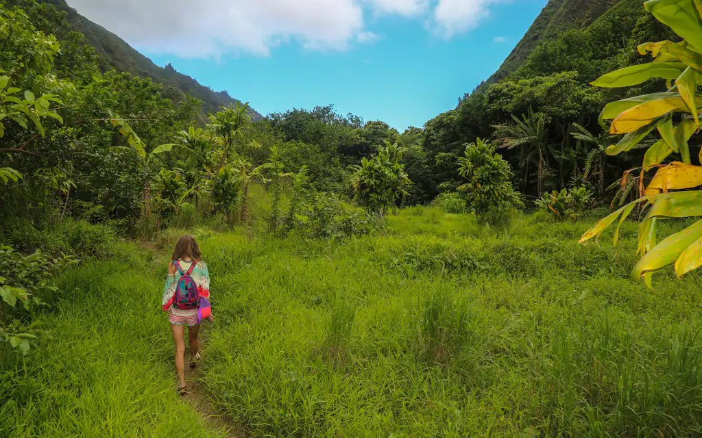
Iao Valley State Park
Check before you go: Iao Valley State Park is closed from April 27 to June 26, 2026 for safety work on its pedestrian bridge and railings, with no public access during construction.
The Iao (ʻĪao) Valley walk is the easiest "must do" on Maui and one of its most sacred places. Officially a State Monument, the valley is reached by a paved 0.6-mile loop that climbs to a viewpoint of the Iao Needle (Kukaemoku), a green clad pinnacle standing 1,200 feet above the valley floor. It's a 20-to-30-minute walk, not a half day, so pair it with Central Maui rather than making a special trip - and reserve ahead, because out of state visitors need an advance booking plus a $5 entry and $10 parking.
Treat it with the quiet it's owed. This was the site of the bloody 1790 Battle of Kepaniwai and remains deeply sacred ground - stay on the paved path and don't stack rocks. Read more in our Iao Valley guide. Hours are 7 am to 6 pm daily.
Distance: 0.6 mi paved · Effort: easy · Time: 30 min · The move: book the out of state reservation before you drive over; mornings are clearest.
Hoapili Trail at La Perouse Bay
The Hoapili Trail - the old King's Highway - runs across the raw lava fields of La Perouse Bay, past the end of the paved road south of Wailea. This is hiking on Maui's most recent lava flow, from an eruption in roughly the 1790s: jagged black rock, zero shade, and a wild, end of the island feel that the green trails can't match (the full La Perouse Bay guide has the dolphins, parking, and snorkeling). It's about five plus miles round trip to the far coves and back, over ankle turning terrain, and it takes most people around three hours in the open lava field area.
It's hard mostly because it's brutal underfoot and oven hot by midmorning - there's no canopy anywhere. Stout shoes, a hat, and double the water. Go at dawn, turn around before the heat builds, and watch for the resident spinner dolphins in the bay early on.
Distance: ~5.5 mi round trip · Effort: hard, lava + heat · Time: 3 hr · The move: dawn only; closed toe shoes are non-negotiable on the lava.
07
When to hike Maui
Two clocks decide a Maui hike: the time of day and the season. The time of day matters more. Every trail here is better early - cooler, clearer, with parking and before the windward clouds build over the summits and ridges by late morning.
When to actually go
By 7-8 amThe daily clock
Coolest air, clearest summit, parking still open, and you're off the exposed stretches before the sun and the windward clouds take over.
Winter (Dec-Mar)Green + full
Waterfalls run hardest and you can spot whales from the West Maui ridges. It's also the wettest, flash-flood season - watch the forecast uphill, not just overhead.
Summer (Jun-Sep)Dry + reliable
The most dependable weather, but the lava-field and coastal trails turn into ovens by mid-morning. These are dawn hikes in summer or they're misery.
After heavy rainSkip the streams
Give Twin Falls and Pipiwai a day. Brown, rising, or roaring water is the flash-flood signal - the sunny trailhead tells you nothing about rain falling miles uphill.
Season tunes the rest. Winter (December to March) is greenest, with the fullest waterfalls and whales visible from the West Maui ridges - but it's also the wettest, when flash floods are a real risk on the stream trails. Summer is the most reliable weather, at the cost of turning the lava and coastal trails into ovens by midmorning. Shoulder months (April-May, September-October) split the difference and run quieter. Whatever the month, the leeward dry trails (Hoapili, Lahaina Pali) want a dry forecast, and the windward green ones (Pipiwai, Twin Falls) want a day or two without heavy rain upstream.
In practice that boils down to a simple order: do the exposed and high trails first thing, and save the shaded ones for later. A summit or lava field hike wants to be done before the sun is overhead; the Pipiwai bamboo forest or Hosmer Grove stays forgiving at 11 am because the canopy does the shading for you. Afternoons belong to the green, covered trails or the beach. And watch the windward forecast even when you're standing in leeward sun - the rain that floods an East Maui stream usually fell hours earlier and miles uphill, somewhere you can't see.

Photo: Kenneth Williams on Unsplash
08
What to pack and how to hike Maui safely
The Maui hiking daypack isn't complicated, but the island punishes two specific mistakes: too little water and the wrong shoes. Both turn a great trail into a bad afternoon, and both are the most common reasons people need help out here.
What to actually bring
Real shoesNot flip-flops
Trail runners or boots with grip. Maui's red mud and wet rock eat sandals, and the lava trails are ankle-rolling rubble.
More water than you think2+ liters
There is none on the trail and the sun does the rest. The single most common rescue cause here is people who brought one small bottle.
Layers for the summitFleece + shell
Haleakala is 30 to 40 degrees colder than the coast and windy. A fleece and a wind layer turn a brutal morning into a great one.
Sun + rain, bothMaui hedges
Reef-safe mineral sunscreen and a hat for the exposed trails; a packable rain shell for the green ones. You'll often want all of it in one hike.
Safety on Maui is less about the climbing and more about water, edges, and respect. Fresh water is the sleeper risk - streams can carry leptospirosis, and a sunny trailhead can flash flood from rain falling miles uphill, so brown or rising water means turn around. Stay on the trail near unfenced lookouts (slick mud plus a photo step is how most rescues start), and remember cell service dies in the valleys and at the summit, so tell someone your plan.
None of this is meant to scare you off - Maui's trails are, on the whole, beginner friendly and well traveled. It's that the few people who get into trouble out here tend to do it the same handful of ways: dehydrated on an exposed trail, caught by a flash flood at a stream crossing, or off the trail at an unfenced lookout. Dodge those three and you've dodged nearly every real risk on this list.
How not to become a Maui cautionary tale
- 1Fresh water
Don't drink it, respect the floods
Streams can carry leptospirosis, and a sunny trailhead can flash-flood from rain falling miles uphill. Brown, rising, or roaring water means turn around - no photo is worth it.
- 2The edge
Stay on the trail
Maui's mud is slick and its lookouts are mostly unfenced. The bulk of trail rescues here are people who stepped off for a better angle.
- 3Sacred ground
Iao is a burial valley, not a backdrop
Iao Valley is one of Hawaii's most sacred places. Stay on the paved path, don't stack rocks, and give it the quiet it's owed.
- 4Always
Tell someone and turn around in time
Cell service dies in the valleys and at the summit. Share your plan, carry out every wrapper, and remember the Haleakala gate and the parks close.
And the respect part isn't optional. Iao is a burial valley, Haleakala's summit is sacred, and these aren't backdrops - stay on the paths, pack out every wrapper, and leave the rocks where they are. If you're basing yourself nearby, our where to stay in Maui guide sorts the regions, and the statewide best hikes in Hawaii roundup covers the other islands once Maui's hooked you.
FAQ: best hikes in Maui
Do you need a reservation to hike Haleakala?
Only for sunrise. Daytime hiking - Sliding Sands, Halemauu, the whole crater - needs just the $30 per vehicle park entry, no separate booking. The reservation people get confused about is the $1 sunrise slot (3 am to 7 am), required to drive up in the dark and booked at recreation.gov. Show up at 9 am to hike and you can walk right in.
Are dogs allowed on Maui's hiking trails?
Mostly no. The national park trails (Pipiwai, the Haleakala crater) and state parks (Iao) prohibit dogs, and that covers most of this list. A few county and forest reserve paths allow leashed dogs, but the marquee hikes here don't - leave the dog somewhere with air conditioning.
Do you need a guide to hike in Maui?
No, for almost all of these. Iao, Pipiwai, Waihee Ridge, Sliding Sands, and Kapalua are all signed, free, and self guiding. A guide only earns its keep on the private land waterfall hikes gated behind a locked road, where you're paying for access and transport, not navigation.
Are there mosquitoes on Maui's trails?
Yes, on the wet ones. The bamboo forest, Twin Falls, and any streamside windward trail can be buggy, so bring repellent. The dry trails - Sliding Sands, Hoapili, Lahaina Pali - have almost none; there your enemy is the sun, not the bugs.
When do the trailhead parking lots fill up?
By midmorning in season. Iao, the Pipiwai lot in Kipahulu, and Waihee Ridge all run small lots that are full by 9 to 10 am. There's rarely overflow parking, so an early start isn't just about the heat - it's often the difference between hiking and turning around.
Is it safe to hike alone in Maui?
Generally, on the popular trails. The real risks aren't strangers - they're flash floods, slick mud near unfenced edges, and dead cell service. Stick to the well traveled hikes here, tell someone your plan and expected return, and turn around early rather than pushing daylight.
Disclosure: Some links on this page are affiliate links. If you book or buy through them we may earn a small commission, at no extra cost to you. As an Amazon Associate, we earn from qualifying purchases.


